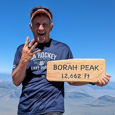
 I’ve done Borah Peak 4 times now and always asked the same questions about this state’s highpoint:
1) How was the snow bridge?
2) Did you carry spikes?
3) What time did you start?
Before I share my perspective, I’m not even sure why people call it a snow “bridge”. It’s not bridging any kind of chasm from one one side to the other. It’s really just a saddle that holds snow well into July. I think it looks more like an icy drift of snow rather than a bridge, but yeah, maybe it’s just easier to say snow bridge… and it does sound cool too.
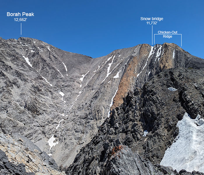
If you’re wondering, what snow bridge? We’re talking about the super short crossing of hardpack snow immediately after Chicken Out Ridge, about a mile from the summit as shown below.
Now then…
Q) How was the snow bridge?
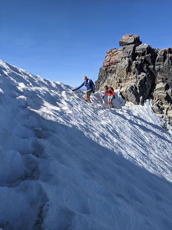
A) The bridge was fine. It’s always fine. Although I’ve only ever done this hike on the 3rd weekend of July, that saddle is maybe 20 yards across and always with decent pockets from previous foot traffic.
#1 – My first time summiting Borah was on July 19, 2014.
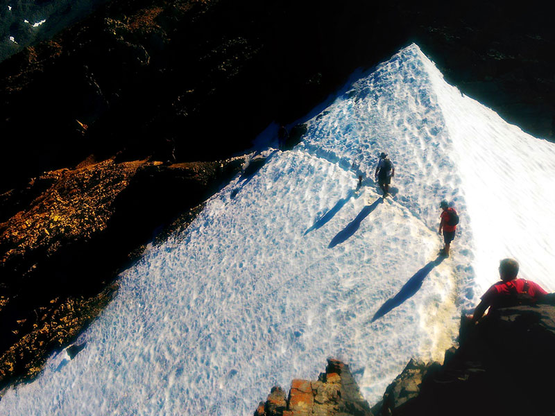
Nothing about crossing this patch of snow for the first time made me nervous, including not finding a handline to get down off Chicken Out Ridge. I was actually glad to figure this out without using a rope.
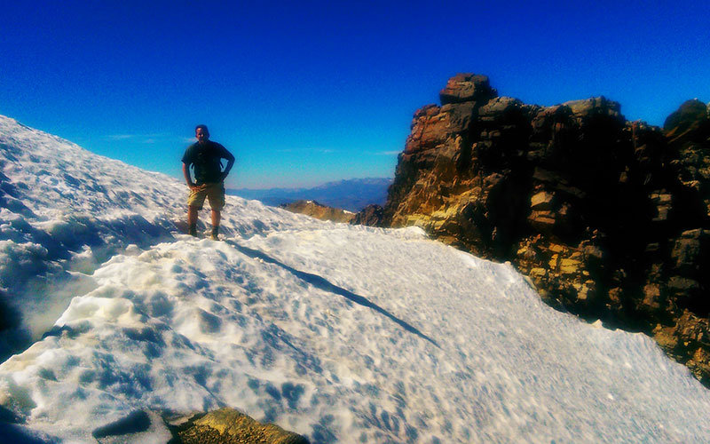
#2 – The second time I submitted Borah was on July 20, 2019.
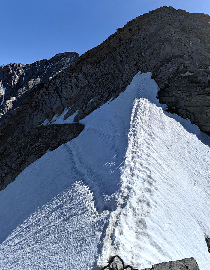
No handline to get down off Chicken Out Ridge this year either. No problem, it’s not necessary.
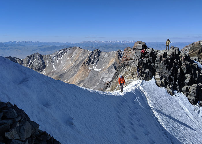
#3 – My third summit was on July 18, 2020. Doesn’t look too different from last year now does it?!
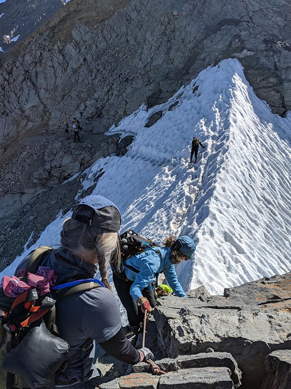
You can see decent pockets again from so much foot traffic.
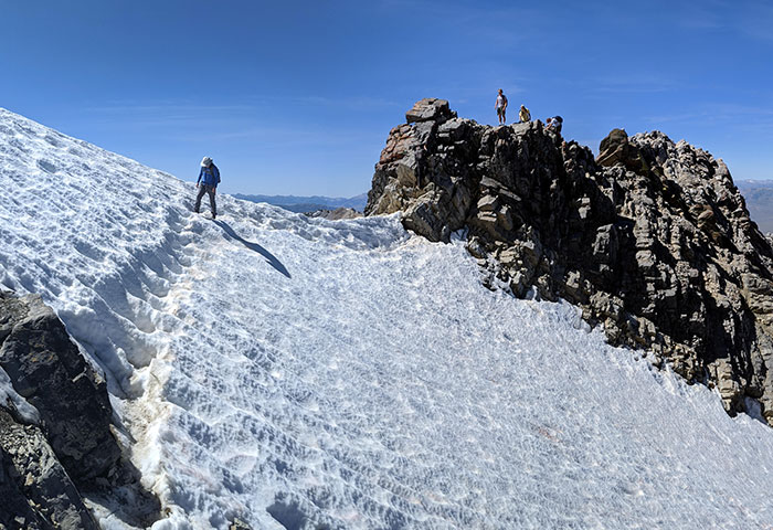
#4 – Again on July 15, 2023. Even after a big snow year, the song remains the same (name that band!).
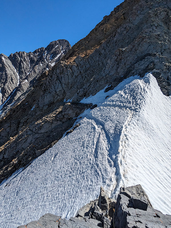
The snow does get a bit soft by mid-afternoon, but it can still be pretty slick and slippery.
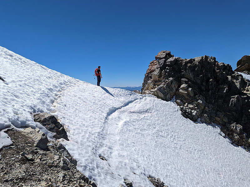
So that begs the next question…
Q) Did you carry spikes?
A) No, I have never felt spikes were necessary for such a short stretch this late into the summer. Some would say ropes, ice axes and crampons are advisable year-round, but I think that’s excessive. I would absolutely use those tools (minus the rope maybe) if it were Spring. However, my experiences in July are hardly any condition for that level of mountaineering gear… and again, not even microspikes imo.
It always looks worse from a distance. Even intimidating. Red line is the trail, yellow circles are people.
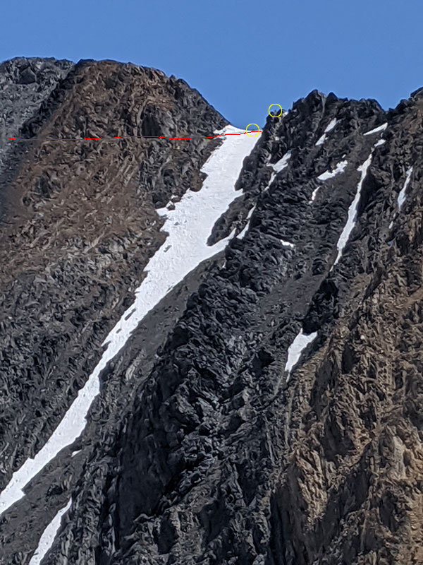
No doubt this slope involves some potential risk of slipping and sliding that would likely end in serious injury or worse. I wonder if there has ever been any such accident here.
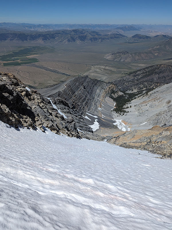
Just take that stretch slow and steady. You will be across it in less than 60 seconds.
And finally…
Q) What time did you start?
A) I like to start around 7a. Even though the sign at the trailhead says it takes 6-7 hours to the top and to plan for a 12-hour round trip, it has never taken me that long. Not even on my worst year. It’s definitely a challenging hike, climbing over 5,100 feet in 4 miles, but 12 hours?? I would tell you to build up your strength if you think it’s going to take that long. Do something smaller and work your way up to tackling the likes of Borah. I think a decent timeframe would be more like 4ish hours up and 3ish hours down. So 7ish hours total! Even 8 or 9 hours is reasonable… but definitely not 12. Train more first!
I still want to reach the summit in under 3 hours without running (I’m a hiker, not a trail runner).
Here are my times so far:
| DATE | START | SUMMIT | TIME UP | RETURN | DONE | TIME DOWN | TOTAL TIME |
| 2014 | 6:46a | 11:52p | 5:06h | 12:57p | 3:48p | 2:51h | 7:57h |
| 2019 | 7:07a | 10:41a | 3:34h | 11:03a | 1:35p | 2:32h | 6:06h |
| 2020 | 7:08a | 10:18a | 3:10h | 10:51a | 1:06p | 2:15h | 5:25h |
| 2023 | 7:50a | 11:15a | 3:25h | 11:47a | 2:18p | 2:31h | 5:56h |
I also prefer the Mountaineers Route as opposed to the standard trail up.
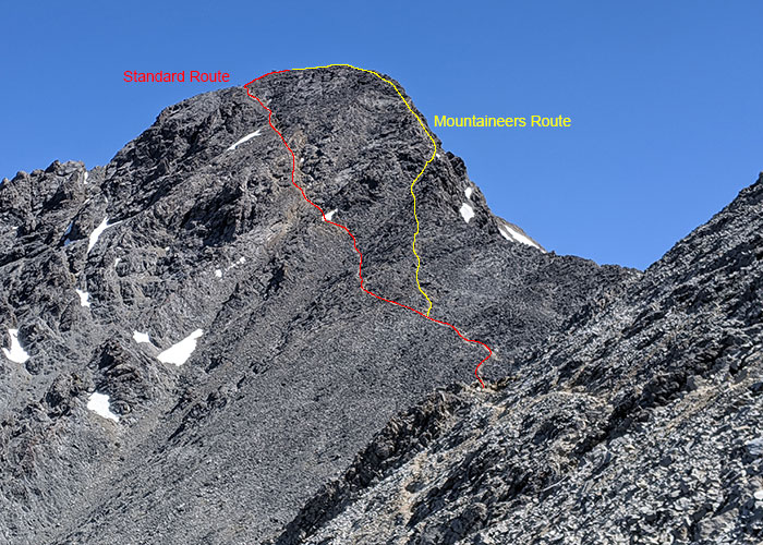
Now I just need to try this route in real mountaineering conditions!
