I’ve been thinking about hiking Mt. Whitney for two years now! It all started after seeing two other parties from my hiking group organize this trip on two separate occasions. Both times were planned quietly due to limited spots I presumed – or perhaps only to include those who were certain not to hold back the group. Either way, an opportunity came up last week to make a plan of my own.
 This plan came together quickly following a few pictures that got posted to Facebook. Those pics showed clear conditions on Whitney after some hikers summited on 11/2. One of the descriptions suggested having only one more week before those conditions could change. I knew he wasn’t wrong. November is still a good time to get Whitney for first-timers like me when a few things line up in your favor: 1) no early season snow 2) great weather from an extended Indian summer and 3) you are free after November 1st when the daily limit on permits is suspended!
I checked my calendar and saw nothing going on.
Hoping to generate some interest, I immediately responded with a comment that said “now would be the time to get it done then“. My whole intent was to see if anyone would bite on this last-minute impulse trip. Sure enough, someone I barely know took the bait and said “I’ll drive if you are serious“.
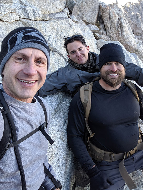
Steve and I have only been on a few hikes together with a larger group here locally, but that was fine with me. We also had another guy express interest, whom neither of us knew. Two days later, Steve, Chris and I were on the road with this plan in mind:
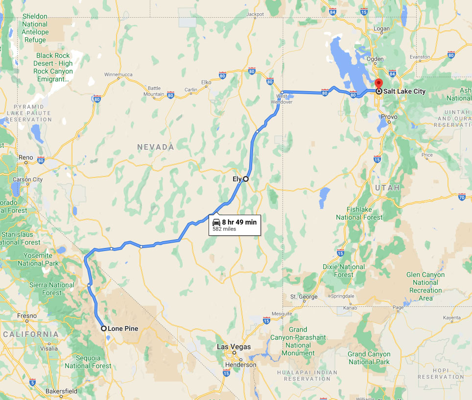
– leave Wednesday night after work, drive 4 hours to Ely and stay at Steve’s sister’s house
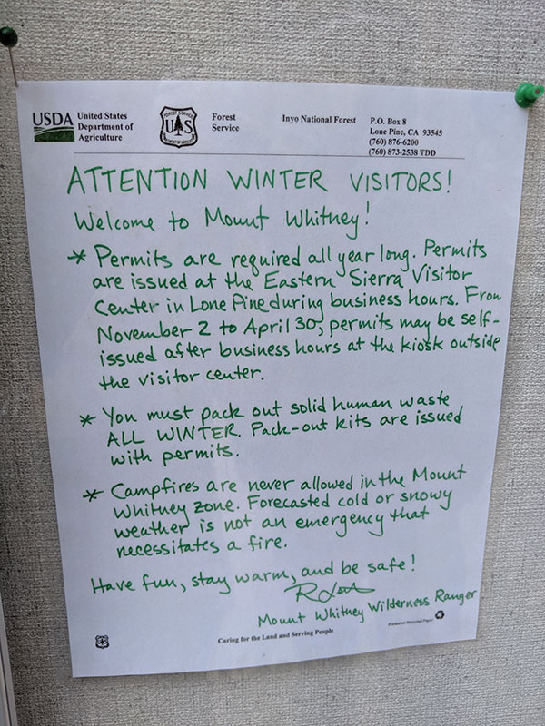
– drive 5 more hours on Thursday to Lone Pine, early enough to get a permit and check things out
– summit on Friday
– drive home on Saturday
…and that’s exactly how this trip went down!
Getting There
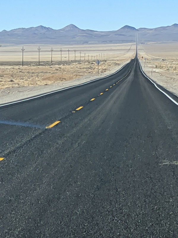
The roads in Nevada are so. freakin. straight. We found it hard to not speed right on through. See that Evel Knievel ramp ahead? We’re hoping it will launch us up and over into the next state!
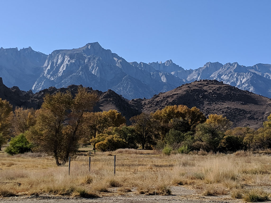
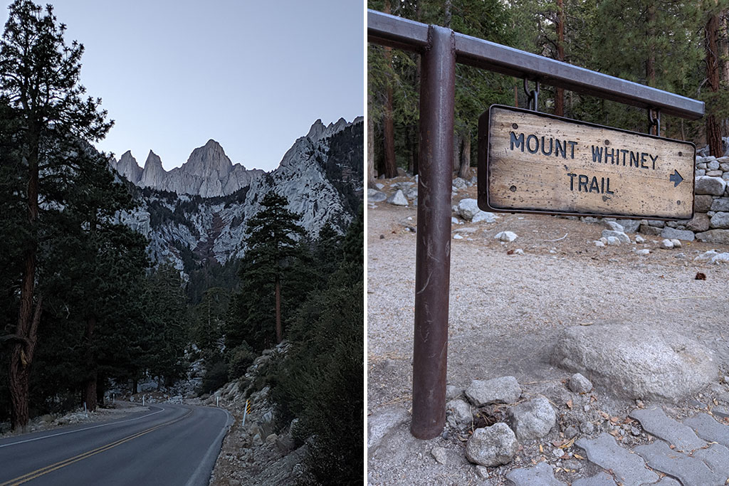
Mt. Whitney can be seen along US 395 as you drive down from Bishop into Lone Pine.
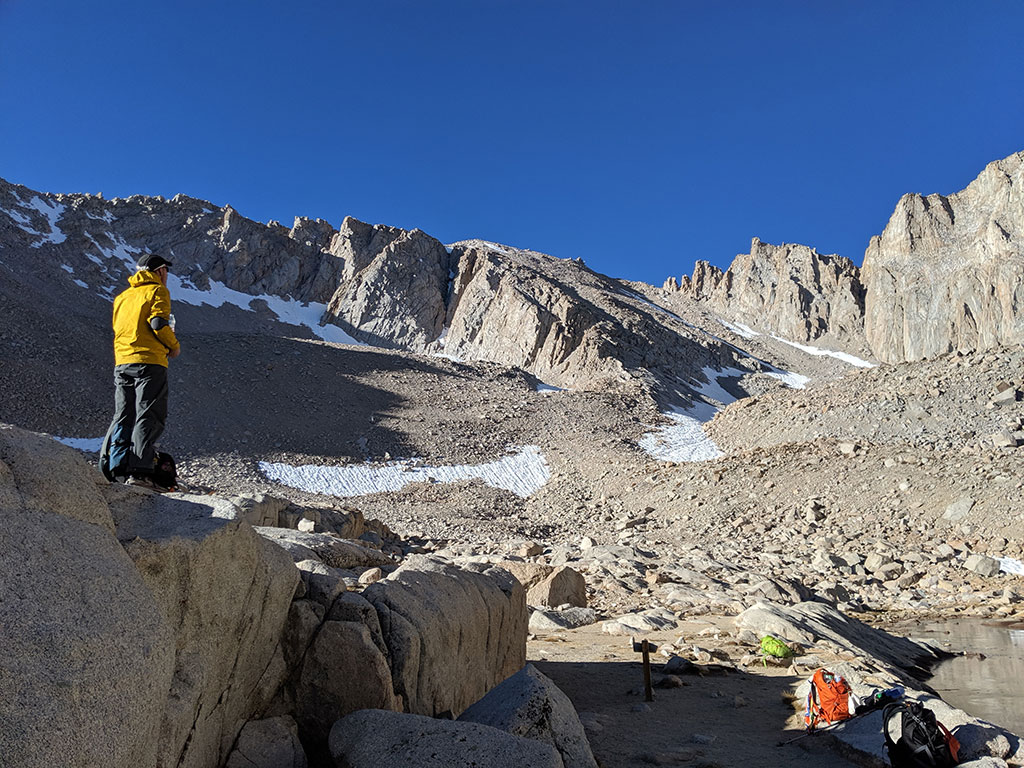
Scoping It Out
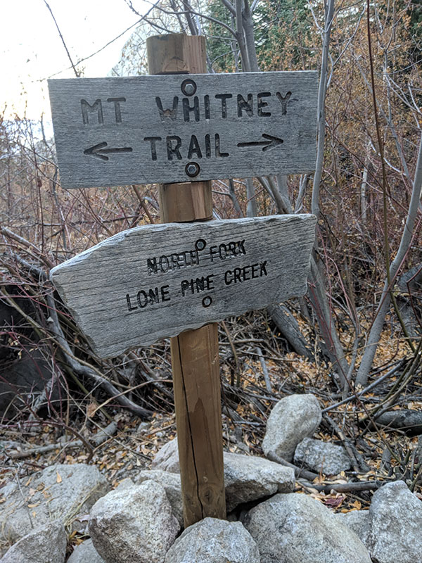
After we got our permit from the East Sierra Visitor Center, we drove to the trailhead and walked up the trail a bit. The sign here marks the North Fork of Lone Pine Creek where you pick up the Mountaineer’s Route. We knew this first mile or so would be done in the dark the following morning.
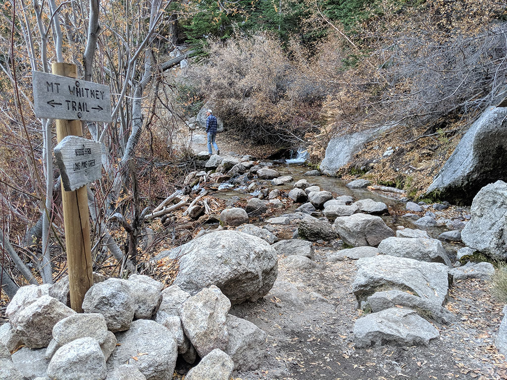
The trailhead is 12 miles up the Whitney Portal Road from Lone Pine and paved the whole way. There is also a bathroom up there that was open and still supplied last weekend.
Summit Day
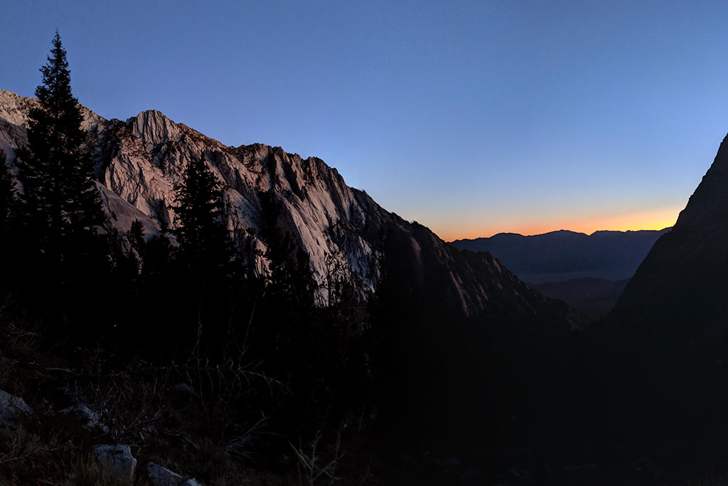
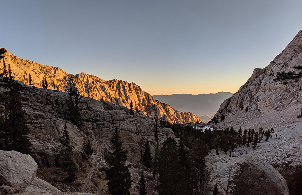
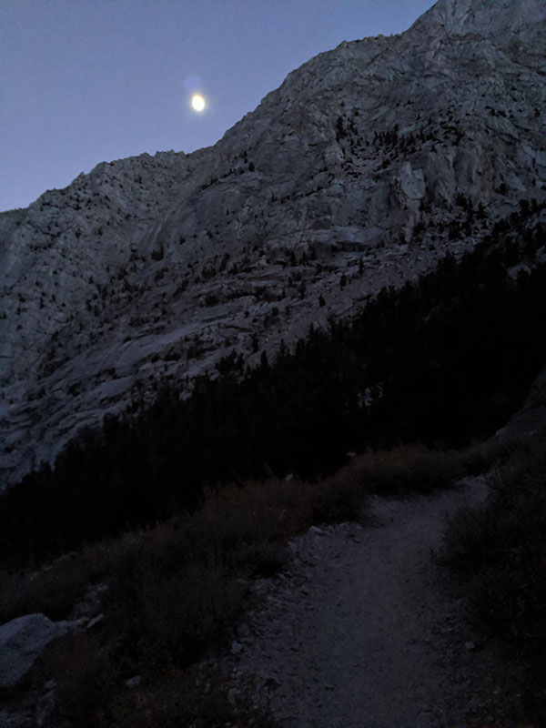
We tried to minimized how much hiking we did in the dark. I really wanted to see everything if we’re going to travel as far as we did to get here. To satisfy that, we were at the trailhead by 5am and on the trail at ten after. As the time approached 6a, visibility was good enough to turn off our headlamps and hike by the light of this spectacular sunrise.
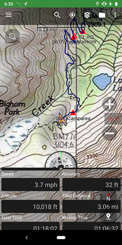
We made it to the Outpost Camp area by 6:30a, at 10,000 feet and 3 miles in.
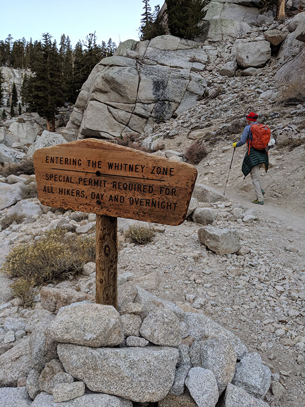
You are now “Entering the Whitney Zone”…made me think of an episode from the Twilight Zone (for those old enough to know what that is).
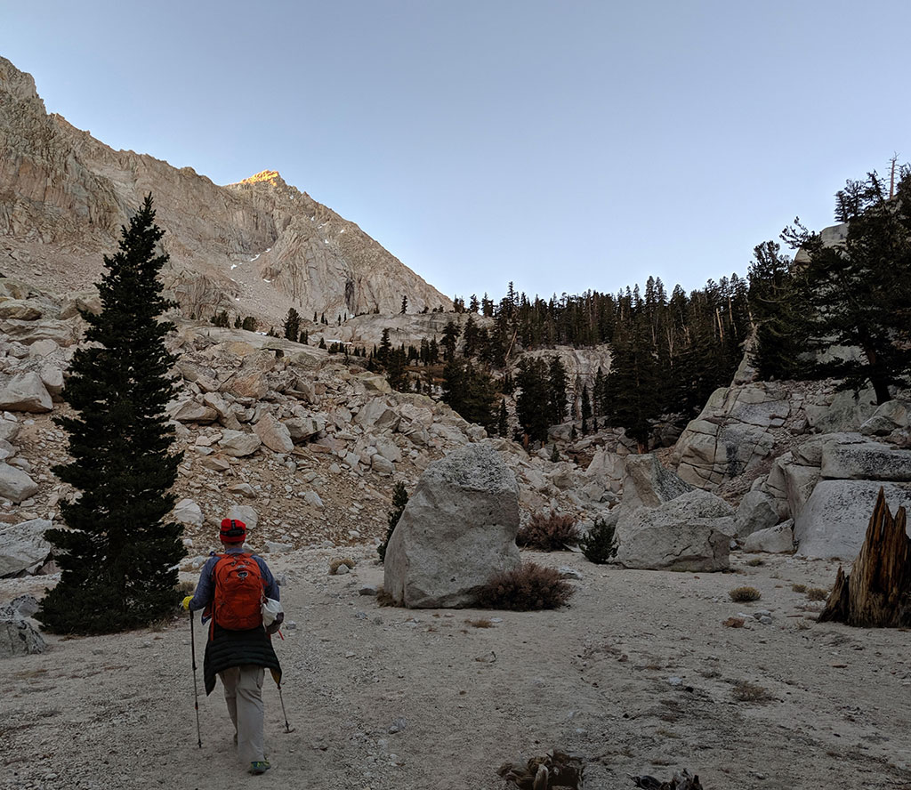
More awesome dawn light as we worked our way up and above Lone Pine Lake.
Making more progress toward Mirror Lake and Trail Camp.
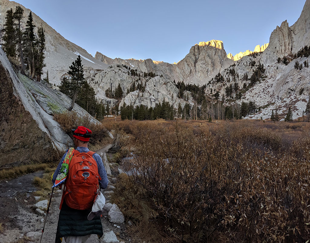
The views just kept getting better the higher we got!
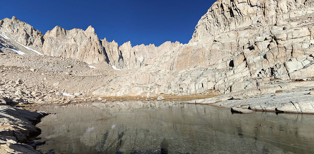
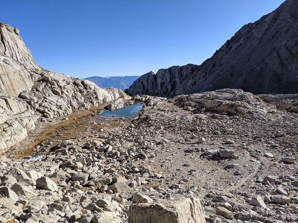
This lake doesn’t have a name on the map, but I’m calling it Upper Lone Pine Lake because it feeds Lone Pine Creek that flows down into “lower” Lone Pine Lake. Either way, this is right next to Trail Camp @ 11,900′, 6 miles up and about 3 hours in.
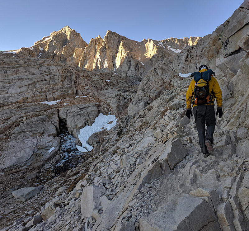
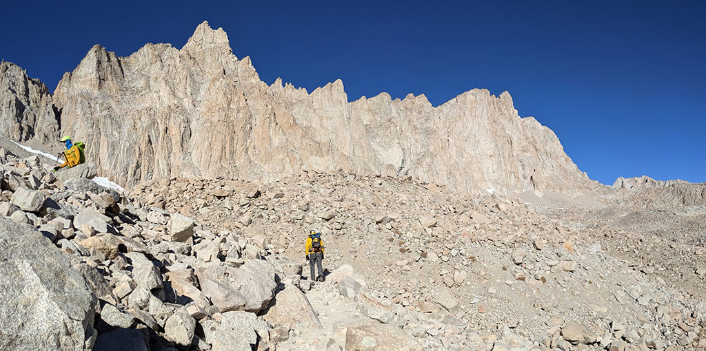
99 Switchbacks
Barry prepares for the next challenge of this hike, a section called 99 Switchbacks that climbs 1,600 feet in 2.5 miles. This guy’s an animal. He called me while we were on the road the day before, just as we pulled into Bishop, and asked if he could join us. He would leave that day after work and drive well into the night so he could meet us in the morning. Of course I said, sure Barry, why not!
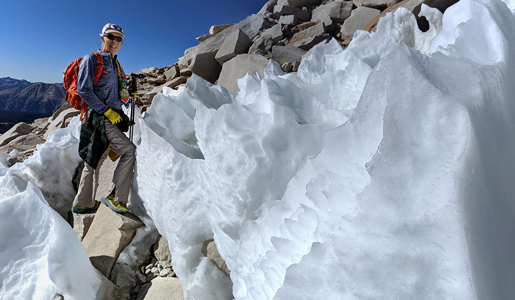
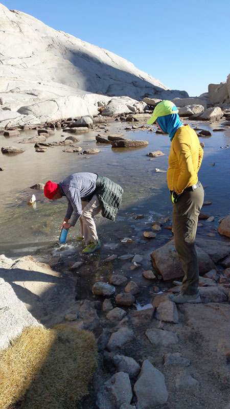
Looking back at Upper Lone Pine Lake as we start up the 99 switchbacks. The is the last chance to refill your water after using rocks to break through the ice.
Not far up this switchback section is where where Barry and Chris kicked it into gear and took off for the top. Steve and I didn’t see them again until they on their way down while we were still headed up. I told you Barry is an animal. So was Chris.
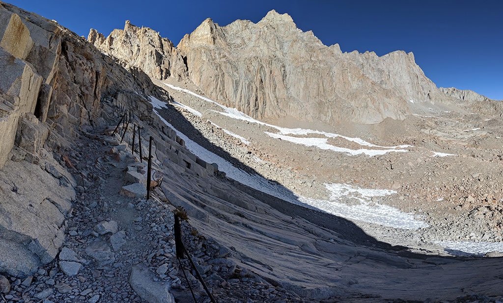
Cable Section
The infamous “cable” section here is steeper than what appears in this pic. Although, I still didn’t think that safety feature was necessary.
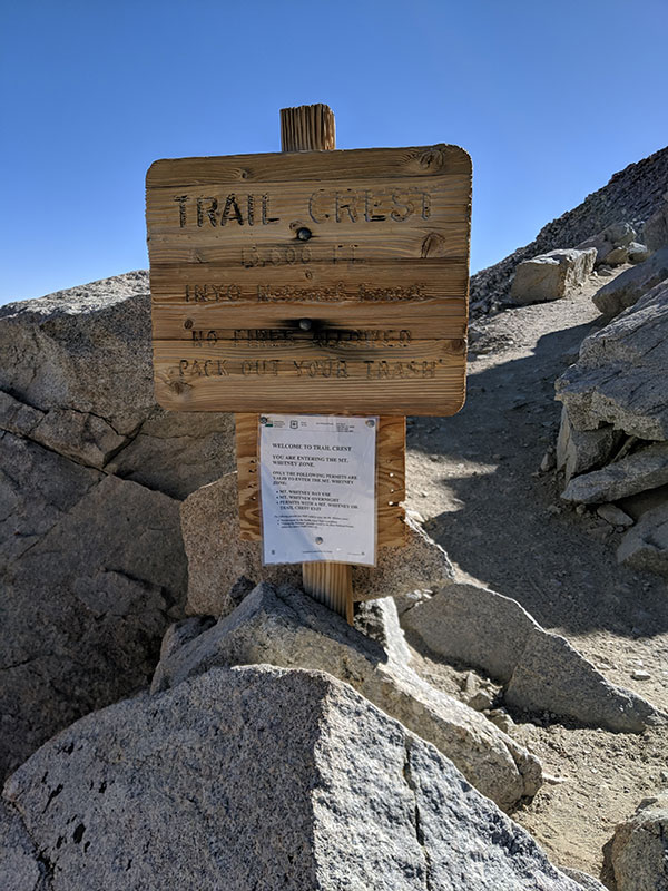
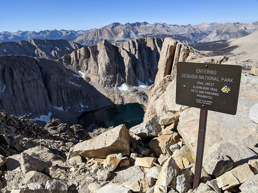
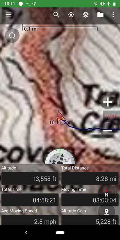
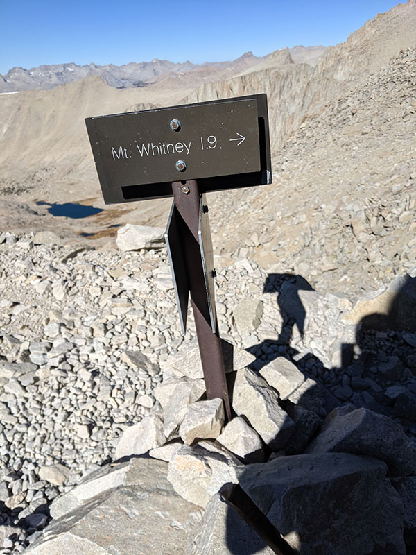
At the Trail Crest saddle, you get your first view into the Hitchcock Lake Basin of Sequoia National Park. This saddle is at 13,560 feet and about 8.3 miles from the trailhead.
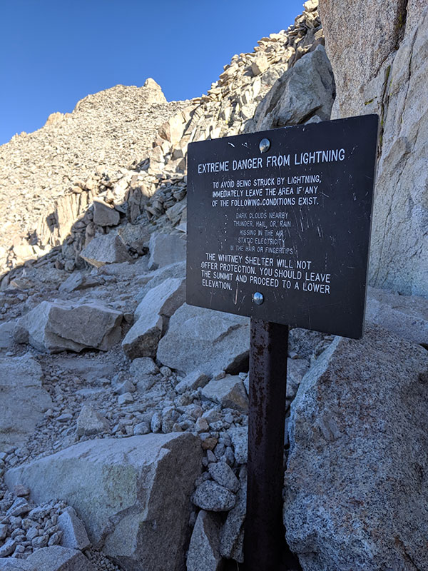
Despite the warning sign, there is no sign of danger today. You are 2 miles away from the summit at this point with the last 1,000′ to go from here. This is also where the John Muir Trail hooks in from the west.
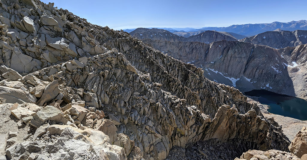
Looking across and back at the top 1/10th of those 99 switchbacks!
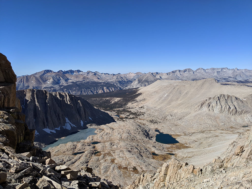
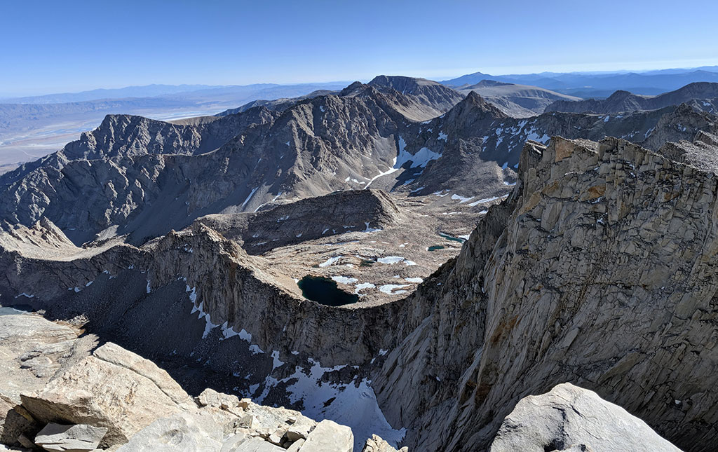
The rock formations on this backside are so awesome. The landscape here is breathtaking!
Hitchcock Lake is on the left, Guitar Lake to the right. The shape of that guitar is something I could see Rick Nielsen from Cheap Trick playing.
I don’t know which tower this is, but they all have a name.
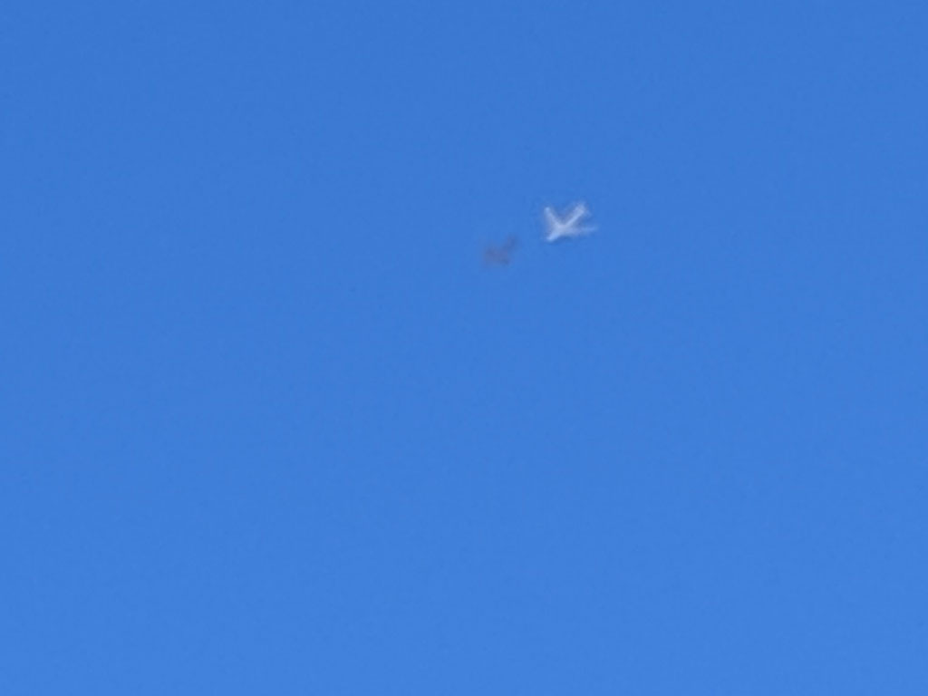
Airplanes were doing maneuvers overhead all day as well. We thought these two were refueling with a gray jet immediately in front of the white one.
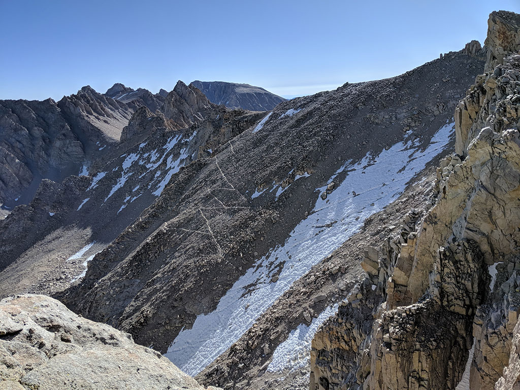
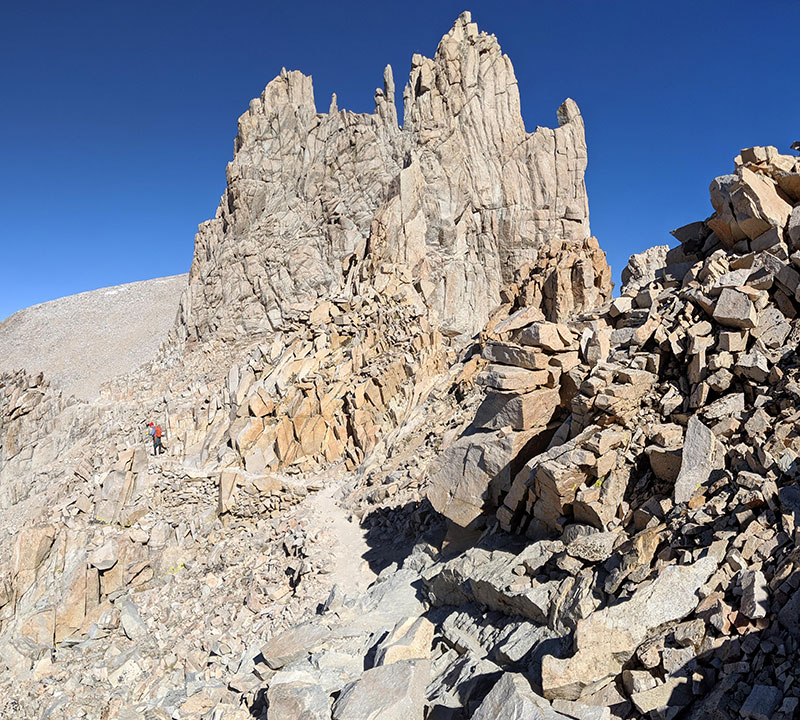
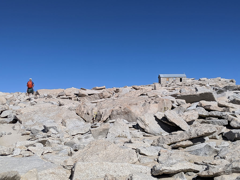
The roof of the summit shack finally comes into view. With another mile or so to go, the trail cuts across this slope and up through that lower patch of snow on the left before heading along the top of the summit ridge.
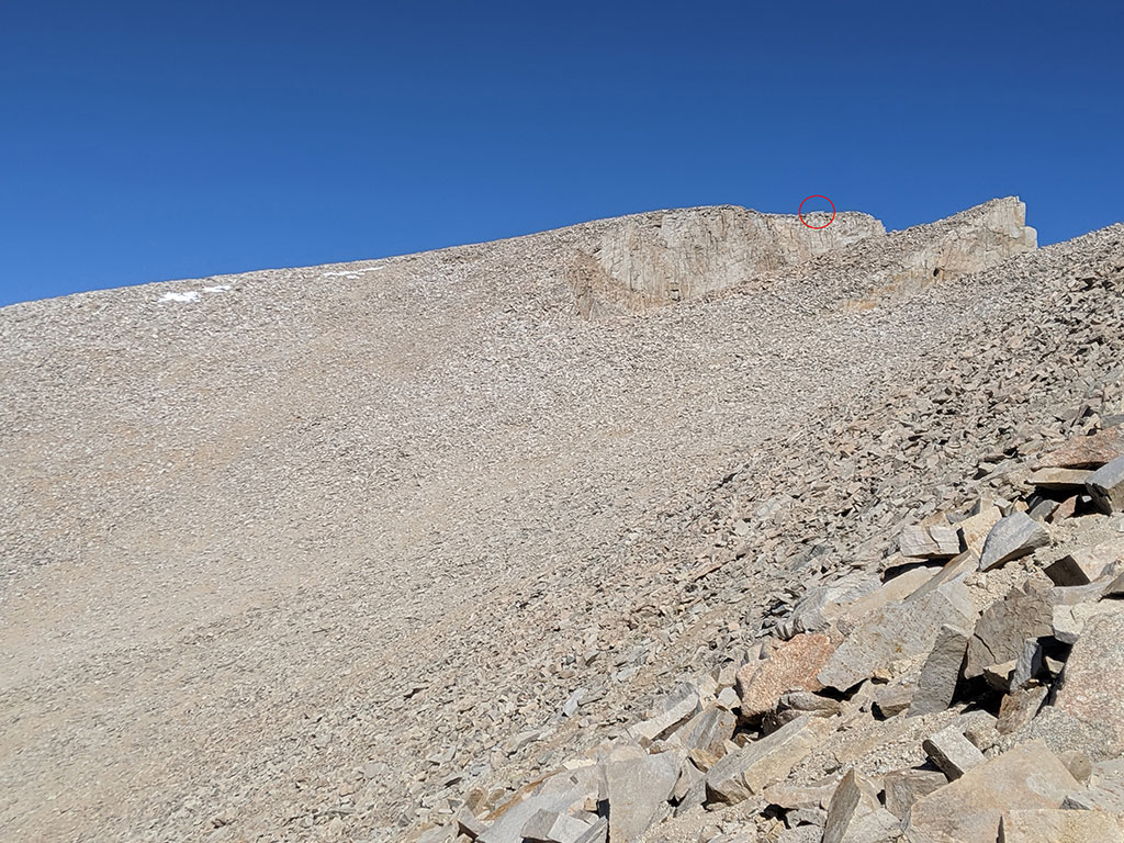
This is that snow patch from the previous pic. It was still frozen hard despite the warm afternoon sun.
Summit Success
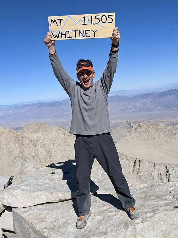
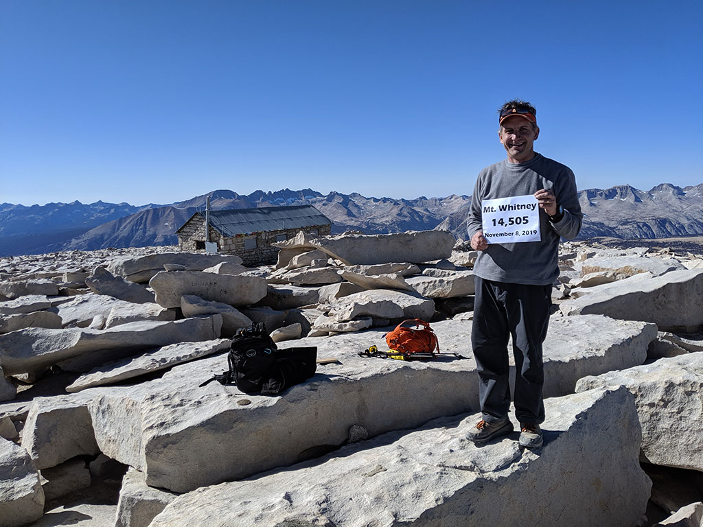
We’re heeeeere.
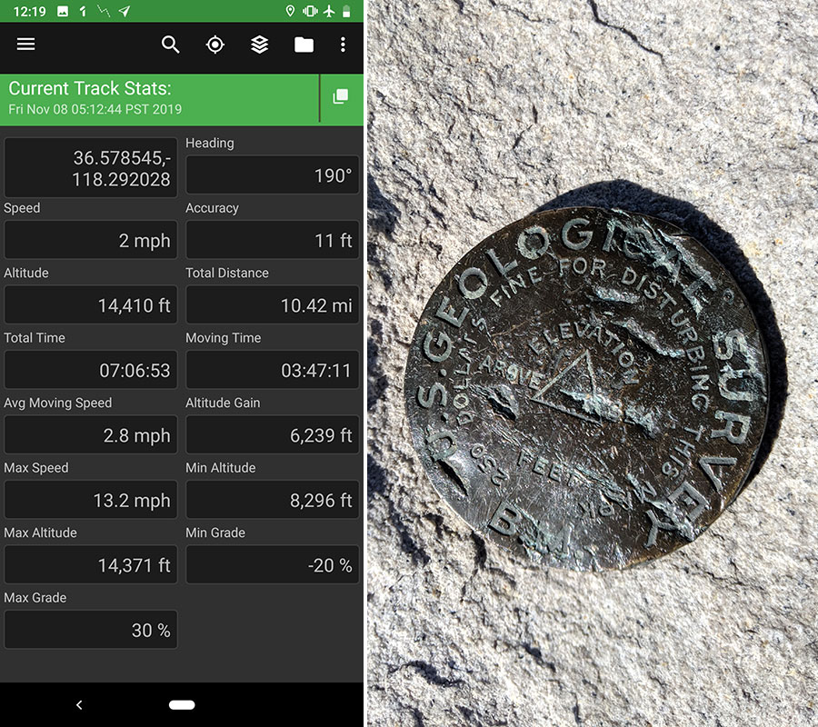
There were 5 of these summit markers all in different spots…couldn’t figure out why but we finally made it… 10.5 miles in 7 hours wasn’t too bad we thought!
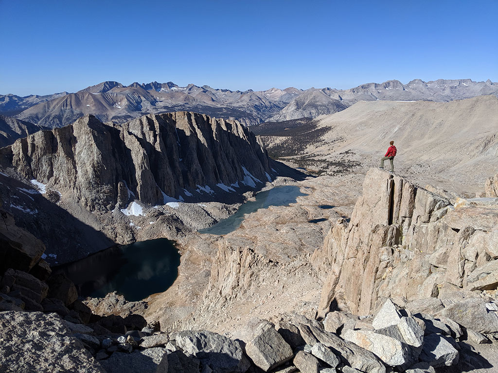
Loved the knife-edge ridge here that separates one basin from the other. We came up from the far right while the Mountaineer’s Route follows along the near side of this ridge. I am now WAY interested in doing that alternate route.
Another bucket item off the list! We spent about 40 minutes up here enjoying 360 degree views, warm rays from the sun and the whole peak to ourselves. At 1:10, we started back down for what we estimated to take about 5 hours.
Semper Fi
On the way down, we ran into this group of Marines who were taking turns carrying a platoon brother up because he lost his legs in Afghanistan. We knew they were in for a long day when we first saw them at 6:30a and found out they had started 2 hours before us (at 3am) and were only 3.5 miles up. All day long I wondered how they were doing and how far they’d go before turning around.
As we crossed over Trail Crest and started down the 99 switchbacks, I was blown away to see them still going at it! To witness such dedication and determination flooded me with emotion. I know Marines are tough, but we also knew what it took to finish the last 2.5 miles without carrying someone and it was already 2:30p. They would not summit before dark at that pace…plus they still had another 10 miles to return back to the trailhead. It was one of the most moving experiences I have ever had on a hike.
Later we found out these guys finally reached the top at 7pm, four and a half hours after we last saw them on the switchbacks, 16 hours from when they first started that morning. I never did hear how long it took them to come down. Maybe they called in a favor and had a chopper come practice an extraction mission from this Whitney Zone.
Final Stretch
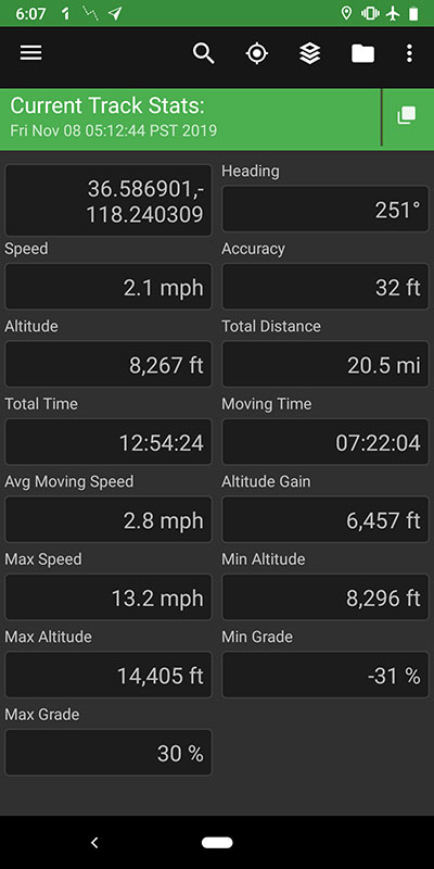
With the days being short now, the sun had set around 4:20p. There was still enough light at dusk to see the trail for about another hour. However by 5:30, it was pitch black and the night required us to put our headlamps back on again. I’d say we timed the day just right because 30 minutes later, we were back at the trailhead (at 6:05) and hungry for dinner.
Overall stats for the day were 20.5 miles with 6,400′ of elevation in 7 hours up and 5 hours down.
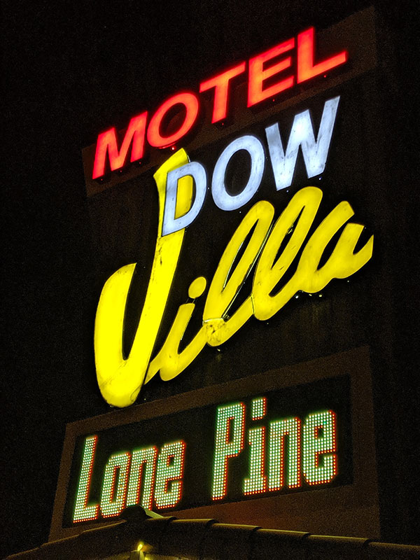
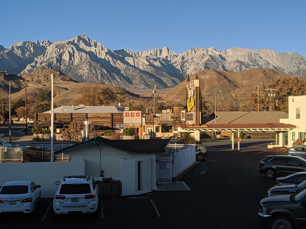
It was nice to shower up and spend a second night at Dow Villa, which is known for hosting Western stars while filming here in the Alabama Hills. Apparently room #20 was John Wayne’s favorite.
This was the view from our room. What a great feeling we had that next morning after such an epic day!
Returning Home
The only thing left was to get in the car and head back home…
Afterward I got home, a friend told me to make sure to stop in at Erick Schat’s Bakery next time we drive through Bishop, CA. Copper Top BBQ in Big Pine was also highly recommended.
